Parcel Management
OffRoad GIS provides a complete solution to address the unique parcel management requirements for County government. To achieve this, the OffRoad GIS system was designed using a unique combination of traditional tabular data management tools with modern geo-spatial tools. What is more important, is that OffRoad GIS was designed with the input of County Administrators right here in North Dakota.
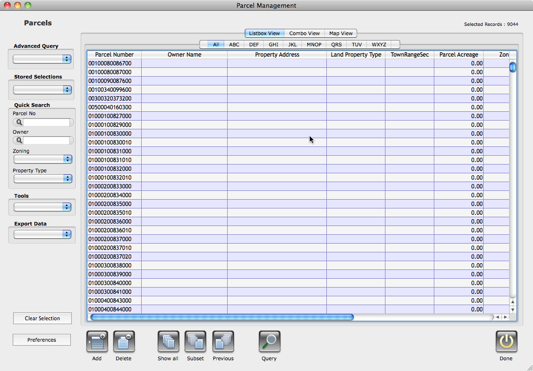
When compared to more traditional management solutions, OffRoad GIS provides many compelling advantages and a much simpler management approach than has previously been available for parcel management. The entire system was constructed around a simple point-and-click approach to take the complexity out of parcel management.
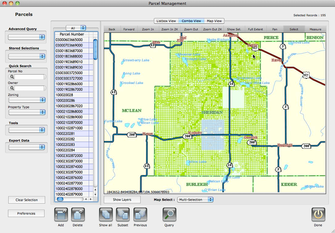
OffRoad GIS includes numerous tools that provide access to your records through simple point-and-click processes. These tools include the preset query features that allow you to drill down within your data by selecting a single entry or combination of entries from preset lists. The parcel management console also provides utilities to store and manage user selection to develop customized user record sets that can be retrieved through a simple one-click process. OffRoad GIS includes tools for generating and managing the spatial components of your parcels. This includes robust tools for splitting and merging parcels and the associated attributes.
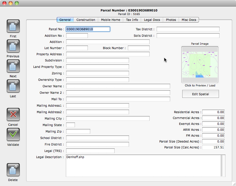
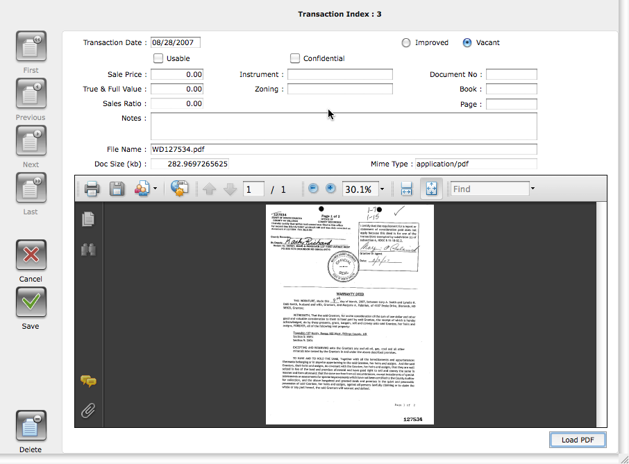
The Parcel Management service includes a broad range of attributes that includes general parcel owner information, construction details, assessment information, and related tax data. In addition, the Parcel Management service includes the necessary features to store and manage the documents and deeds tied to each parcel as well as photos, images, and plans.
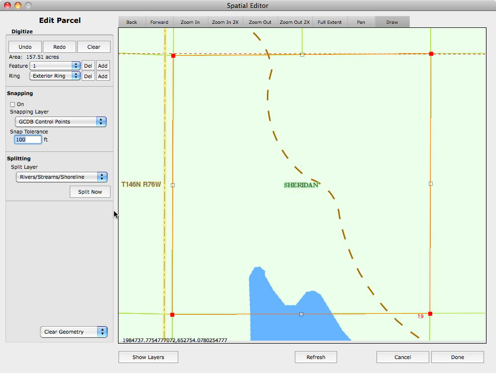
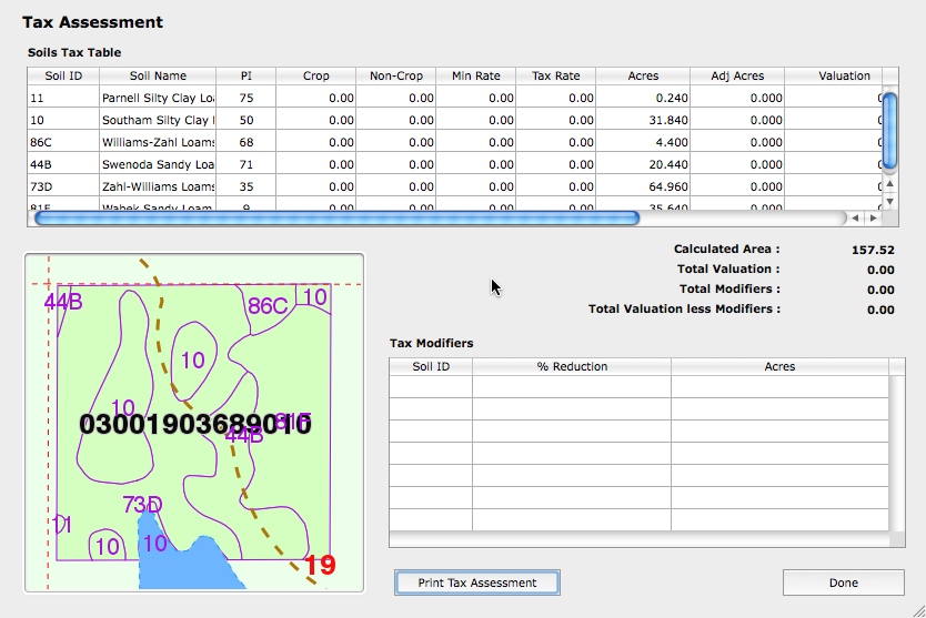
Along with managing the parcel data directly, OffRoad GIS includes other peripheral features to help eliminate complex redundant management operations. These include a soils tax module and a tax modifiers system that are integrated with the parcels. As a result, any changes to the geometry of the parcel, including splits and merges, automatically updates the soils based tax tables associated with any agricultural parcel.