Web Services
Web services have become a standard expectation for state and local government. Over the past few years, these expectations have grown to include interactive map services. While there are many ways to push data and maintain map services, most require complex management procedures, along with maintaining the data.
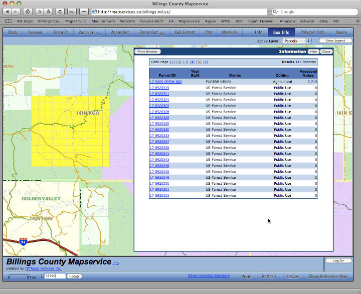
OffRoad GIS provides integrated web services that include robust map service capabilities. By integrating the web services, OffRoad GIS presents a zero-admin footprint for managing your web and map services. What we mean by this is that your only requirement is to manage your data. The spatial service engine essentially takes care of the rest. There is no additional work required.
In addition to your base data, OffRoad GIS also provides the necessary tools to include all of the peripheral data as well. This includes any photographs or deeds attached to the parcels. Beyond just serving data out, the web services also provide tools that make it possible for your public users to provide input and feedback.
The Web Services provided as part of the OffRoad GIS system go well beyond simple web services. OffRoad GIS web services support user account creation, which allows your web users to create individual accounts. Through user accounts, web users can save and store map extents. Using established accounts, OffRoad GIS also accommodates tiered access. This allows you to assign users to different tiers that support different levels of access to your data. As an example, you can elect to restrict access to your documents and deeds to a particular user tier.